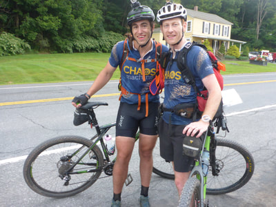
The 2018 24-hour Longest Day AR, put on by the New York Adventure Racing Association, was Chaos Machine/Lifestraw’s first race back in action after Untamed New England, a four-day expedition race where we raced hard and finished above our expectations.
With family obligations holding lead navigator Rick and back-up navigator Kate out of this race, Evan and Cliff (that’s me, your narrator) made a game plan as we headed west to Windham, New York: go hard, hard, hard to make up for likely navigational miscues.
We cruised out of Maine on Friday afternoon, stopped for an indigestible Italian-themed dinner somewhere in Western Massachusetts, and found a quiet, hay-strewn patch of dirt at the base of the Windham Ski Resort to pitch our tent at around 10 p.m. I slept great but Evan had some trouble.
Wake-up was around 5 a.m. for a 5:30 a.m. check-in at the nearby VFW hall. We arrived still groggy but the VFW provided coffee, which was very much appreciated. With all the tables in the hall occupied (those damn Canadians from Mercators took over our saved table when we went to get our maps, and yes Kit, I consider Vermont to be part of Canada:), we made a makeshift home at the greeting table by the front entrance to the hall, which just so happened to be right in front of the three bathrooms. We considered commandeering all the TP and charging by the square but felt that might not engender the warmest relations with fellow racers we might have to team up with during the race.
Instead, we got busy with the maps. Over 30 minutes of staring and outlining, the course took shape: a short trek/rogaine/coasteering section; a bike-o then a cruise down to the paddle put-in; an 8-mile paddle around a reservoir; another transfer bike leg; then a massive point-to-point foot section that would clearly be the crux of the race, followed by one last bike-o and a ride up and over Windham Mountain to the finish.
After we finished with plotting our route and marking up our maps, we got a bite to eat and got our bikes and paddle gear dropped off. Then we waited. There seemed to be a lot of time between check-in and the 8:15 a.m. race briefing, 9 a.m. bus ride and 10 a.m. start. We had arrived right at 5:30 because one thing I’ve learned over the years is to never assume you’ll have time in the morning - there’s always more to do than you realize and always less time than you think you’ll have. However, this race seemed to be the exception. We had a lot of time to use and re-use the bathroom, check and re-check our route, formulate a strategy then reconsider it, and come up with Plans B, C, D, and then offshoots of those.
Finally, Aaron and Eric concluded a well-executed briefing and we boarded the two waiting school buses for the 45-minute drive to the start. We offloaded at the ominously-named Mine Kill State Park and had a fun 10-minute stroll into the park to the start line. The weather was nice and we had a feeling it would stay that way. We were psyched to get going.
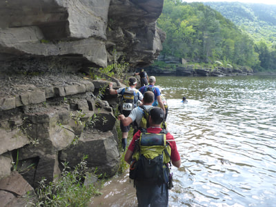
The race started with a run down a dirt road that became a trail. A snaking line of racers ahead of us then turned off to the right, bushwhacking through tall grass to CP 1, on an island in Schoharie Creek. Claiming navigator privileges, I sent Evan to go get it. It took a minute for me to figure out how to get from CP 1 to CP 2, but when Evan pointed out a line of people clinging to a cliff above the creek to the north of us, I could see that was the obvious route. So we got in line and had a fun 10 minutes of walking on a thin rock ledge that was invisible beneath the ankle-deep water. We got to CP 2 and faced a decision - turn back and try to fight our way through the people behind us on the ledge, or swim for CP 3, which was clearly visible on an island straight ahead of us. My decision was made easier after I fell in the water punching CP 2.
“Evan, we’re swimming!” I shouted behind my shoulder. Facing the hard truth that his teammate - who had all the maps - was swimming quickly away from him, Evan went for it and jumped into the creek.
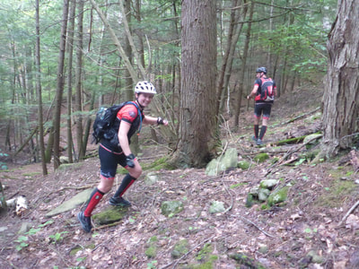
We emerged at the foot of a creek, shook ourselves like wet dogs, and headed upstream to the first foot-O point. There were five CPs between a trail and a couple of creeks and we generally made quick work of them, thanks to teaming up with orienteering specialist Tom Rycroft. There was one point on a flat piece of land near a creek that had us wandering through thick brush.Tom made the mistake of following me and ended up keeling over into a briar patch….after we got him upright, he looked like he had been on the wrong end of a razor fight. On our way up a steep hill to the TA, we saw Rootstock and Dave Lamb hitting a CP on their bikes and I snapped a couple of pics - don’t get to see them often during a race!
We jogged it into the TA and tried to quickly transition to our bikes. Tom and I co-navved in a clockwise direction starting with the northernmost point, and we collected the seven CPs in workmanlike fashion. Teams were still tightly bunched here and there was a lot of traffic on the tight trails. Not until we finished the bike-O and got cruising south on pavement did we find ourselves out of the sight of other teams. We stayed with Tom through the bike and skidded into the busy paddle TA on the Schoharie Reservoir in the top third of the field.
The paddle consisted of three CPs to the north of the reservoir, and another two on the south end. Tom had hinted he might skip the southern two points and he had a scorching fast transition. While we were scrambling to try to figure out what food and drinks we wanted for the paddle, Aaron Courain and Joe Brautigam had us keeling over laughing as Joe was jogging around the TA while munching on a chicken wing and Aaron badgered him not to throw it in the woods. Finally, Joe perched the bare chicken bone on a tree branch and gruffly told Aaron he would retrieve it when he got back from the paddle.
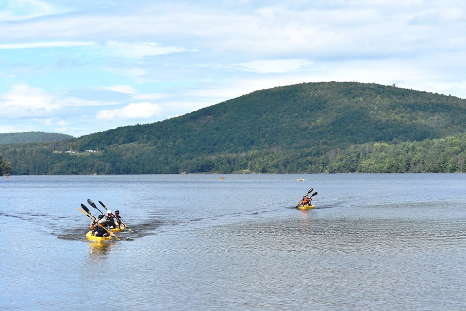
Once we had decided on Bugles and Starbucks Double-Shot Espressos, we hit the water and jumped into our sit-on-top tandem kayak. Learning from our weight-distribution mistake from last year’s USARA Nationals (where Evan was in the front of the canoe and Starker was in the back, leaving us plowing through the water like we were planting seeds), we piled both our backpacks in the stern. We started off a little out of rhythm, primarily because my shoulder was a bit tight and I was fidgeting around trying to get it to loosen up (this has happened since the broken collarbone last summer). The CPs were easy to find by following the conga-line of boats shuttling from point to point. Between the second and third point, we ran into Tom going the opposite direction and he confirmed he would be skipping the southern two paddle points. The third CP was located at a beautiful waterfall and Evan ran out to pick it up while I snacked on Bugles and drank espresso and admired the view. Tough life.
With Evan back in the boat, we started really motoring. We passed one team and then set our sights on the evergreen jerseys of Joe, Jeff, and Corinn of Untamed New England. We pushed hard and caught up to them right at the first southern CP and passed them on the way to the next CP at another gorgeous waterfall. Evan asked me, “When was the last time you were ahead of those guys in a race?” And the answer was, “Never."
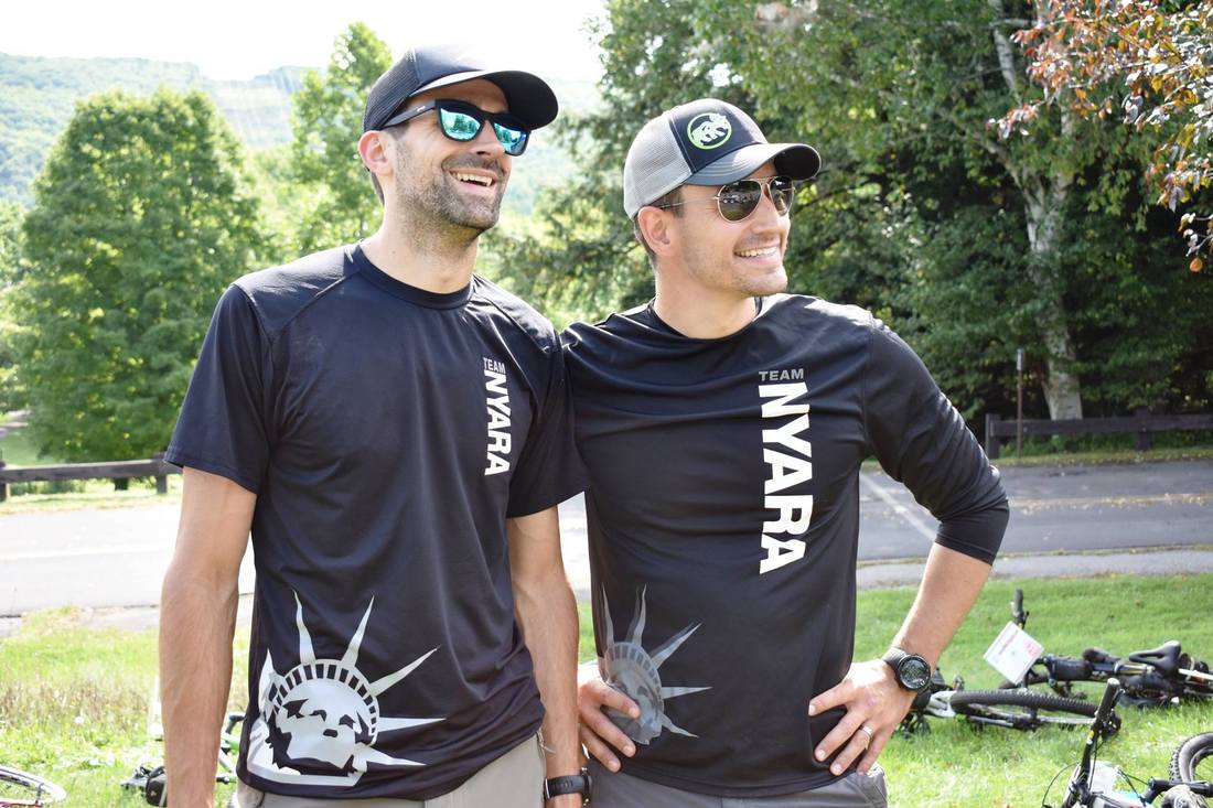
We hit the takeout and tried to hammer the transition, an effort which ended up costing us a bit down the road (more on that later). We stuck around for just long enough for Joe to grab his chicken bone, then took off back the way we had ridden in, then east toward Gilboa, Conesville, and then up a climb that started on a dirt road and ended on a doubletrack up to the TA, which turned out to just be a truck. We dropped our bikes alongside NYARA, which arrived via a different route at the same time, and headed out on foot for what we knew would be a very long section.
We started the hike at 3:30 p.m. with a long hike up a doubletrack to ridgeline, then opting to do a big loop and obtain three optional CPs. The first was on the trail along the ridgeline, about a 20-minute fast-trek to the point. We hit it and turned around at a run, passing NYARA on the way. Reached a trail junction and turned downhill, running all the way to the CP just as we ran out of water. The CP clue was “stream” but we got nervous on the way down to it that it appeared to be dry. However, about 100 feet above the point, the stream started running and by the time we hit the flag, it was a nice burbling brook. We yelled in celebration as we slurped the dregs out of our Camelbaks and got a cool, clean refill.
The next point was on a knob to the southeast but I found it tricky. I didn’t want to gain too much elevation unnecessarily, so I tried to use my altimeter to line up the ridge and then parallel it to reach the knob. However, because we didn’t take the most direct route, I think we gave up some time here, and sure enough, just as we reached the CP, we saw Mercators approaching from the more direct angle. We said hi and then skipped off in separate directions; for us, we went downhill to the east looking for a paved road. It took us longer than I thought it would to reach the road, and even longer to get to the top of the climb up the road to attack the next CP, which was back on the main route that all teams would be using to traverse this leg. It was about then, as darkness began to fall, that we realized that this section was going to be really, really long.
We saw the NYARA guys (Brian & Co.) at the crest, said hi, and continued on, moving quickly up through a steep hilltop and some thicker brush to get the mandatory CP. Steering directly north, we came out on a dirt road and made one of our two nav mistakes of the race. We turned right at the road and headed down it until it dead-ended. We saw one road on the right and no turn toward the left, which is what we were looking for. There should have been a Y-junction but we never saw it. So instead of getting close to the next hilltop CP for our attack, we faced the tough decision of trying to go back and find the correct road, or bushwhack straight north toward the CP. Standing at the dead end in the road, we took a moment and got our headlights out then followed NYARA Montbell and Erin Rycroft’s team up the steep, thorny, cliff-riddled mountainside. It was terrible. And worse, it took forever.
Near the top, NYARA glided sneakily off, while we muddled around for a bit looking for the point. It was foggy and the point was in a thickly wooded area. We must have slowed down because NYARA was gone by the time we found the CP. Frustrated and seeking to make up time, we booked it down the hillside, on the lookout for the Long Path trail. Keeping one eye on the steep terrain and the other on my altimeter, I got nervous when our altitude dropped below where we were supposed to meet the trail. Thank god for Brian Gatens - we heard his voice above us fade slowly away, Doppler style, and we followed it back uphill and found the trail. We then ran smack into Erin and Stina from Runs with Maps coming down from the CP, and we proceeded to a junction between the Long Path and a jeep road. I convinced the ladies to join us for optional point #28 and on the way, we ran into the Mercators duo and Mark Walsh, who had been looking for the point for a while. We walked to a sure bend in the road, backtracked to where we now knew the attackpoint was, and worked our way up the target reentrant. It appeared to peter out, but we spread out and continued ascending, and I was the first to hit the “old road” where the CP was located. We followed it down and found the point, first try, bingo.
There was one more point along the Long Path before heading steeply downhill to the waypoint on a bigger, paved road, where there was water and volunteer staff waiting. We had to be through the waypoint by 1 a.m. and we got through by 10 p.m. On the way through, we struck up a conversation with a fast-moving guy named Tommy. We found out he was the navigator for Naturkompaniet Pioneers, an accomplished Swedish team, and so I not-so-subtly strung out the conversation through Tommy skillfully guiding us to another hilltop point. He guided us back to the Long Path and then took off up the trail. Ten minutes later, there was no trail. We flailed around looking for a blaze but ultimately I just took a compass bearing north and we went off through the woods. For about 15-20 minutes, we thought we would have to bushwhack all the way to the TA, still another six to eight miles away. That would have been brutal and slow. So the relief was palpable when we rejoined the trail another half-mile on. What followed was much less dramatic - a long, long trek along the trail with no points to collect. But the breeze made the temperature perfect for trekking and we made good time, at times conversing, at times walking silently and enjoying the quiet and incomparable freedom of being in the woods at night.
A long time later, we saw the bright orange shirt belonging to Tommy flaring ahead of us in the dark night, torqued in a strange position. As we got closer, we saw it was indeed Tommy, sitting on a log with his head in his hands. I shook him and asked if he was OK, and he mumbled incoherently. I asked him if he wanted to walk with us for a while, and he seemed grateful for the offer. But the offer wasn’t completely selfless; in exchange for a caffeine pill, he gave us much-needed salt pills (Evan’s had turned into mush during our swim the previous morning), some food (we had both underpacked on calories), and most importantly, a superlative navigator. Within 15 minutes, Tommy went from dragging his feet and slurring his words to rocketing ahead and blazing a trail. Together, we found a mandatory point located in a tricky spot to the northeast of a hilltop, and an optional point to the west of the Long Path. At the point, Tommy made the choice to go for two additional optional points while we decided to skip them - our first skips of the race - and head for the TA.
We retraced our steps back down to the Long Path and continued northwards, picking up one final point at a pond’s edge, where Evan scared a beaver on his way down to punch and it loudly plopped into the water. Then we followed the trail another mile or so across a paved road and finally into the transition area for the final stage, at around 3 a.m.
We took a little time here to refuel, as we were pretty much down to our last Frito and candy bar at this point. NYARA provided some awesome maple waffles and it was fun to see Denise Mast, a NYARA founder I believe, who flew in from Colorado to volunteer. While we ate, I changed up the maps and double-checked my preferred route for the upcoming MTB-O. In his race briefing, Aaron had said we should leave at least an hour-and-a-half to get up and over Windham Mountain to the finish, so that meant arriving at the trailhead at 8:30 a.m. While that still gave us five hours of time, we had a dozen or so CPs to hit first, and I knew I was going to have to be on it with the maps to clear the section with enough time to make it to the finish before the cutoff.
We did a cheeky end-around for the first bike CP, using paved roads instead of the trail, and then returned to the TA on our way through. We then picked up four more points on what were graded as easy, green-coded trails, but which were still rocky, rooty and difficult to move fast on. Then came a brutal climb, a series of switchbacks which we eventually deemed unrideable and dismounted to push up. We arrived at a lean-to, which had a CP flag hanging on its side and a fire going, along with Eric hanging out greeting teams. We had an option to drop our bikes here and head out on foot for three optional CPs, but the distance and climbing required to get them made us doubt we had the time to get them (one was at the top of Windham High Peak, a 1,200-foot vertical gain from the lean-to). We stopped and chatted for a bit, giving ourselves a quick opportunity to down some more fuel, as we were still feeling low from the draining hike. Out of the lean-to, there were a number of confusing trail junctions, especially as it was still pitch dark out and we couldn’t see very far down any of the trails. We searched for a sign for the Cranberry Bog Trail but didn’t find one. But after a few moments of inspecting all our options, I made a call to take a trail that seemed to be heading the correct way, and my hunch was right, as we found the junction for the Cranberry Bog Trail after about 10 minutes of riding. Getting that CP, we worked our way south, hitting a couple more CPs and almost literally running into Runs with Maps. I joked with Erin that it was ironic I was racing more with her than Tom.
Then we faced another tough decision; the next CP was on a trail to the south, but the fastest way to get to it involved a bushwhack down 300 vertical feet of steep, messy terrain. Being the great sport and teammate he is, Evan agreed to go for it with a laugh that sounded half-nervous and half-maniacal, and so we grabbed our handlebars and started manhandling our bikes through the mess of downed trees and loose rocks below. But we popped out perfectly on the trail we were looking for and rode right into the next CP. By now, it was more or less light out. We clicked off our lights and proceeded over more fun trails, which had clearly been carefully crafted out of the slab piles they refer to as mountains in the Catskills.
Hitting the top of the Berm Up trail, we punched at the CP and then pointed the wheel downhill. Holy hell, that trail was sweeeet! Berm after berm, we weaved our way down the mountain. We must have gotten super-amped up on stoke, as we completely missed the junction with the Dead End Connector trail - didn’t even see it, though to be fair to us, everything is pretty blurry when you’re riding that fast. We ended up on a dirt road, where we stopped for a moment to decide whether we had enough time (or will) to re-ascend and get the CP on the Dead End Connector Trail. We decided we didn’t want to risk going up a trail which had people bombing down it at incredible speeds, and so instead we cut around County Road 40 and back-doored our way into the second-to-last CP on the section. But giving up on that one easy CP stuck in my craw and put dark thoughts in my head about losing the race over “the one that got away.”
Evan tactfully helped channel my anger into getting CP 52, which we attacked from Highway 296, dropping our bikes and again approaching from an angle different from what we thought the RDs had intended us to do. But the point was in a pretty flowering bush by a picturesque stream and I ruled it the prettiest point of the course.
It was now 7:50 a.m. and when we got back to our bikes, Evan made it clear we had to book it to Windham. So we did, even though of course it was all uphill (it seemed like this entire course was uphill). A case of Cokes greeted us at the bottom of a double-track trail that looked like it headed directly to the summit without so much as a slight bend. Evan took the lead and over the next 30 minutes, he didn’t stop once. He didn’t so much as look back, and I knew with both our brain powers severely diminished due to food and sleep deprivation, if I let him get out of my sight, I might not see him again until the breakfast buffet at the VFW.
Soaked in sweat, we hit the last two CPs on the map, one in a meadow and the other on top of the ski lift on the top of Windham. At the top, in his classic dry wit, Evan said this was tied as the longest day he’d had all year. I was too tired and hungry to fully appreciate the joke, but fortunately I caught it on video.
We saw NYARA jetting ahead of us and made it our mission to track them down. The beautiful berms and perfectly sculpted tabletops made it hard to to go fast as we cruised down a mountain that boasts a UCI World Cup Downhill course. We caught NYARA by the bottom of the run and then Evan turned on the afterburners. I did my best to stay in his slipstream and we torched the pavement on our way into the VFW Hall and the finish.
Once we handed in our passports and got inside the VFW, the adrenaline wore off pretty quickly. And then there was just hunger. We finished at 9:34 a.m., and the buffet opened at 10 a.m. We waited as patiently as possible, tiding ourselves over on hot coffee, which on our empty stomachs, tasted amazing but left us even hungrier. We congratulated Rootstock and Dave Lamb on their joint victory. And then the line formed for the buffet. But before I could get to any food, the guy in front of me, which turned out to be Scott from Mercators, started teetering and semi-collapsed into my arms. Kit and I got him seated and Denise Mast ran to get him some OJ. The sugar helped him revive a bit and as soon as it looked like he wasn’t imminently going to pass out, I selfishly moved to the buffet, as I felt like if I didn't eat something soon, I might be the next one to keel over.
I had secretly been craving scrambled eggs since about 8 p.m. the previous evening, and I couldn’t have been happier to see ladles scooping eggs in front of us. Twenty minutes and three servings of eggs later, the good feelings of the breakfast were topped off with the sweet dessert of being announced as division winners for the two-person male division. Rootstock and Dave Lamb hit an amazing 57 of 58 points, NYARA Montbell got an impressive 55 of 58 to take third-place overall, and we got fourth, missing six points (though it should have been five; damn you Berm On Trail!). This was definitely my best result in an AR and it felt good to be inching closer to the top of the standings. Evan, in just his fourth overnight race (after 2017 Nationals and this year's Maine Summer AR and Untamed New England), was a trooper and never had any lows.
Looking back on our result, the most amazing feeling is knowing we can do better. The nav can be cleaner, the downhills can be run, and the transitions can be faster. Can’t wait ‘til next race.

