Our old friend, the Stubborn Mule.
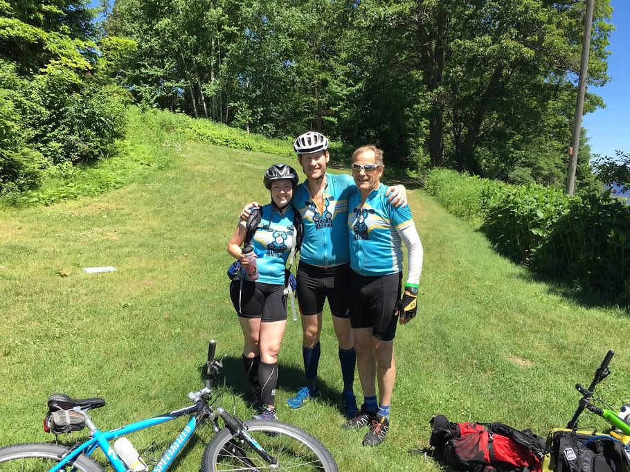
Starker, Kate and Cliff all have a strong affection for the Mule, given its location in our former stomping grounds in Wisconsin and the fact that it’s run by Paula Waite, the organizer of both the Mule and its sister race The Stubborn Fool, the first adventure race we ever did. Back in 2013, the Stubborn Mule was our second-ever race. We had competed in it several times when we lived in WI, but always the 12-hour version. Our long-held desire to tackle the Mule’s 30-hour version loomed large as we tentatively placed it on our 2016 “wish list.”
Thankfully nothing got in the way on our calendars and we were able to make the trip back to the Midwest and compete in this awesome race. A bad analogy, but we kinda felt like the child who has grown up and come back home for the holidays.
Kate and Cliff flew into Madison, Wisconsin, and Starker pulled up in ole Sketchy. But wait...why was Starker smiling like a creeper (OK, more than usual)? Because ole Sketchy had become Sketchy 2.0! A new minivan awaited us. Starker was very proud of his new purchase and showed off all of its special features, vowing that the four hours of driving ahead of us would be a dream of comfort and convenience.
In addition to all the spiffy new accoutrements of Sketchy 2.0, the drive was made even easier by the wide, straight roads of the Midwest. We got to check-in and met up with Rib Mountain, Amber and Steve from MAD S and Gregg Pattison/Orion for dinner, chatted with Heather Kluch and Michael Garrison for a bit, and generally had a great time catching up with all our Wisconsin AR friends. Having flown his own small plane to the race, Gregg needed a ride to our campground, which Starker was happy to provide (likely so he could show off Sketchy 2.0), and we all got to sleep at a reasonable time after doing all our night-before-race preparations.
Race morning started before dawn with a change in our tents into our race clothes and dealing with some annoying northern Wisconsin locals - a hungry swarm of mosquitos, Wisconsin’s official state bird. We drove the 10 miles past the Pla-Mor Bar to the Lakewoods Resort in Cable. The check-in process went smoothly and as a bonus, we didn’t have to plot any points this year, relieving the usual pre-race stress by a significant amount. WEDALI arrived just as the final instructions were being given out and was not to be seen as we lined up on our bikes for a rolling start on the road leading out of the resort. Though they were odds-on favorites to win the race, their late start would cost them at least 20-30 minutes, which would make things tighter between them and Rib Mountain. We were excited to see who came out on top.
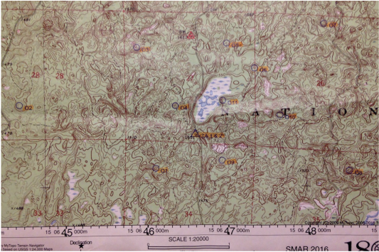
Meanwhile, the race started and we carefully road in a tight crowd for the first mile or two on rolling pavement. Then the 12-hour racers split off from the 30-hour course, and we quickly found ourselves mostly alone on the soft gravel roads familiar to all of those who have adventure raced in the Midwest. We did a 20-mile loop without much trouble, though we saw one team - Toporadicals, we think - have a chain break and when we passed them, they said it was their second one. (Thank goodness for Quiklinks, right?). We wound up in the first TA at 7:22 meaning the 4 CP ride took us 1:22. Kate got the map for the 10-point O-course and got working on an attack strategy, while Starker and Cliff got our bikes out of the way and sorted ourselves out for a long hike. Having a look at the map, we began strategizing about dropping at least one point, given that two of them were way far out on each side of the map. We knew it was early in the race, but we also knew that Paula’s nav is notoriously tricky, and that in all likelihood we would have no realistic chance of clearing one of her courses.
We headed into the woods and struggled a bit with the first CP (CP 9, the one directly southeast of the TA), overshooting a bit and climbing up the wrong hill. About 15 minutes of confused time later, Kate corrected and we found the CP, then set off on a straight east bearing towards CP 8 (we could do them in any order). We were looking for what looked to be a wide, active road on the map, but other than hiking trails and old disused narrow logging roads, we didn’t see anything that resembled what we were looking for. After what felt like an eternity of hiking east, we all came to the conclusion we had gone too far and headed back to our last known point, a hiking trail about 10 minutes back. We hit it and hiked north on it until we found an intersection, and that clued us back in on the map. Turns out, we had passed the “road” twice - going out and coming back - and hadn’t realized it because it wasn’t much of a road at all. We got back out to it and took it to CP 8, which was way down in a deep depression. We saw Gregg coming in as we were headed out, and he admitted he too was struggling with the map early on in this section.
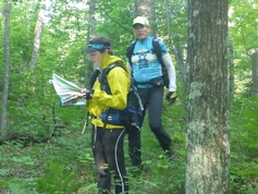
From CP 8, we headed north on the road to CP 7 and found it easily. But the sheer distance between points revealed to us this section was going to take a long time to get through. Fortunately, Kate then hit her stride navigationally, and we got CP 10, CP 11 flawlessly, grooved our way to CP 6, CP 5, then used CP4 as a waypoint to find the trail that led to CP3, which was in a depression so deep it felt like a chapter from Journey to the Center of the Earth. At this point, we had been on this stage for more than five hours, and so we decided to bail on CP2, officially ending our chance to clear the course. We passed the TA on our way to get CP1 and saw from the lack of bikes there that we were among the last of the 30-hour teams still out on the section. We got some encouragement from Paula and the volunteers (who may have been cheering for us thinking we were done with the stage), went out and back to find CP1, which we did without a problem. The stage took us 5:53 total. To give you an idea of how fast the top teams move, WEDALI cleared the section, including the distant CP2, in 3:14, while Rib Mtn. Racing, who we know are lightning fast, cleared in 4:25. Just nutso.
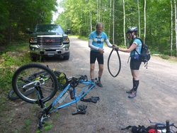
Anyways, we got back to the TA and tried to make a quick transition, but we were greeted with - what else? - a flat tire on Kate's bike. Starker got to work fixing it while Cliff and Kate took the time to examine the maps for the upcoming stages. The TA ended up taking us 30 minutes, but we eventually got on some pretty nice, easy mountain bike trails, leading into a longer mountain bike section that Paula had told us would be pretty epic (in a good way). We struggled for a bit finding the trail, checking out about a mile of extra trail looking for it. But eventually we found what we were looking for, and started on the 10-mile stretch of really nice, smooth and rideable singletrack. We rode for a couple of miles, but Kate was falling behind. Eventually, we needed to stop, with Kate needing a little break from the heat and the stress of riding fast on a technical trail.
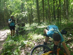
At this point, we started a little back-and-forth with two other four-person teams, as well as a two-person male team. They passed us on our break, then as we were riding, we passed one of the four-person teams with one of their women sprawled out along the trail in obvious distress. We stopped to see if she was OK, but they said she was just sick. So we rode on, hitting some really fun ups and downs that were difficult but not technical. Then we ran into some troubles of our own when Starker's chain broke. With the snap of a Quiklink we were back on our way in less than 10 minutes. After identifying the make of a rusted-out car that was somehow way back in the woods, we popped out on a gravel road marking the end of our mountain biking - we would we skip one point up on a fire tower (and about 3 more miles of trails) in order to make up some time.
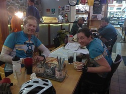
We rode down the nice gravel road past the airport where Gregg Pattinson had flown into, then made a left on a county road into the town of Cable. Cliff spotted a promising looking restaurant and we parked our bikes and went in. Just in time, as it turned it. The rain started as soon as we crossed the threshold. While Cliff asked for two of "whatever is fastest to cook," Kate and Starker looked out the windows and started hatching other plans. The rain had immediately picked up to "full drench" and the lightning and thunder kicked up, making us feel like perhaps it might be wise to wait this one out. We ordered some root beers, Cliff got an affogato, or ice cream with two shots of espresso poured over the time from the handy coffer bar/ice cream stand located inside the building with the restaurant, and we feasted on wood-fired pizzas as we laughed at our good fortune. I'm sure the other teams, huddled under their canoes on the next paddle stage, would have been rethinking their decision to be so damn fast in the earlier part of the race if they knew what we were enjoying by having gone at a more leisurely pace.
We rode down the nice gravel road past the airport where Gregg Pattinson had flown into, then made a left on a county road into the town of Cable. Cliff spotted a promising looking restaurant and we parked our bikes and went in. Just in time, as it turned it. The rain started as soon as we crossed the threshold. While Cliff asked for two of "whatever is fastest to cook," Kate and Starker looked out the windows and started hatching other plans. The rain had immediately picked up to "full drench" and the lightning and thunder kicked up, making us feel like perhaps it might be wise to wait this one out. We ordered some root beers, Cliff got an affogato, or ice cream with two shots of espresso poured over the time from the handy coffer bar/ice cream stand located inside the building with the restaurant, and we feasted on wood-fired pizzas as we laughed at our good fortune. I'm sure the other teams, huddled under their canoes on the next paddle stage, would have been rethinking their decision to be so damn fast in the earlier part of the race if they knew what we were enjoying by having gone at a more leisurely pace.
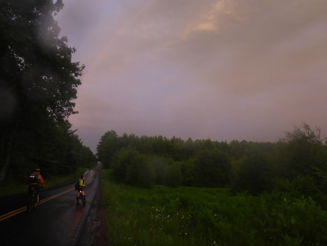
After an hour, the thunder and lightning stopped and we jumped back on our bikes, backtracking along the full course for a couple of miles of rails-to-trail to pick on the last “mountain bike” CP. Then we retraced our tracks in the muddy trail to town, and headed out on a 10-mile bike along some beautiful backcountry roads, enjoying the sight of the damp asphalt artfully strewn with fallen leaves from the recent storm. We picked up three CPs as we rode under a full rainbow arching over the setting sun. Pretty unreal.
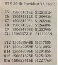
It was fully dark when we arrived at the canoe TA, which was located in a campground. We found a whole pile of canoes clearly intended for use in the race, but couldn’t find any volunteers to check in with. We walked around for about five minutes, checking out the nearby area, until we decided to backtrack back out a bit, eventually finding the TA in a campsite. Upon arrival, we saw one other team plotting points, and after a gear check, we got the coordinates to plot. Kate and Cliff are not big fans of plotting points ever, but we find it especially difficult in the middle of a race, where we’d like to be “racing instead of tracing,” as Cliff likes to put it (actually, Cliff just made that up). Our race brains were in full effect and, staring at the long, jumbled line of what looked like computer code, we struggled mightily. Fortunately, RD Paula was kind to us, and let us know when our plotting was off (there was probably some self-interest involved; if she had let us go, we would still be wandering lost deep in the Wisconsin woods). We finally got things sorted out after about 30 minutes, and hit the water about 45 minutes after coming into the TA.
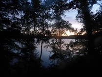
The lake was busy with adventure racers coming and going to the various CPs strewn around the lake. From the multicolored hues of the glowsticks attached to every boat’s bow and stern, it was easy to follow teams’ progress as they glided smoothly over the calm water. We saw WEDALI and Gregg Pattison close to the second lake CP, and then Rib Mountain about 30 minutes on toward the third point, which was also the take-out for a short, four-point foot-O.
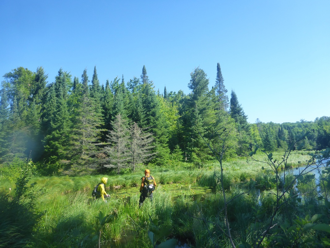
The first o-point caused us a little difficulty. It was on a hill next to a swamp. We found both without much issue, but the vegetation was so thick that working our way uphill was a supreme effort and seeing further than a foot or two ahead was impossible. We stumbled around at what we thought was the top of the hill, groping around in vain for a glimpse of some orange and white cloth. Finally, we pulled the plug and descended back to the trail that was our attack point.
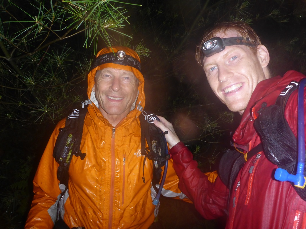
Reassessing, we ducked into the swamp, traversed to the east side of the mountain, and attacked again. This time, the vegetation was much thinner, and we worked our way uphill easily, with Starker taking the lead. Near the top, Starker spotted the CP and we celebrated with high-fives and a photo.
Kate guided us to the next two CPs without problem, using an old forest road as a guiding feature. The fourth and last CP on this mini-section, however, caused us more difficulty. Deeply involved in a conversation, and perhaps dealing with some fatigue after 15+ hours of racing, we walked too far on the trail and hit an improved road, our catching point. We turned around and started looking too soon, wasting about 20 minutes looking in each turn in the trail for the point. Finally, Starker found it (once again) hiding about one-third of a mile back from the road on the trail. Relieved to clear this surprisingly difficult part of the course (Paula later admitted to us she expected all teams to have gotten through this part in daylight), we had a laugh session on the long walk back to the canoes as we joked about feeling we were the only team in the race, not having seen another team for 3+ hours.
We reached the canoe and decided to get another easy CP on the lake to kill some darkness off and time the beginning of the big O section to coincide with daylight. Kate took a nap while Starker and Cliff tried to sing to stay awake, but with the dead calm and total quiet on the lake, it was difficult to stay awake. As we got close to the TA, Starker’s head started to bob and Cliff almost fell out of the stern. The sound of hitting the concrete boat launch/takeout jolted us awake, and as we ran to the TA, we could see the first light of dawn coming up over the lake.
We reached the canoe and decided to get another easy CP on the lake to kill some darkness off and time the beginning of the big O section to coincide with daylight. Kate took a nap while Starker and Cliff tried to sing to stay awake, but with the dead calm and total quiet on the lake, it was difficult to stay awake. As we got close to the TA, Starker’s head started to bob and Cliff almost fell out of the stern. The sound of hitting the concrete boat launch/takeout jolted us awake, and as we ran to the TA, we could see the first light of dawn coming up over the lake.
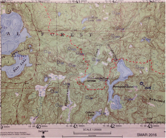
We got the final O-course map from Paula, who we had to wake up from a nap in the big tent at the campsite/TA. At first light, and after already having raced for almost 24 hours, it was a bit intimidating - 21 points spread across a 10-mile square area, with no clear route to take between them, and large bodies of water dividing the course into four different sections. We assumed clearing it would take us about 8-10 hours, and we gave ourselves a cutoff time to leave the section of 10 a.m., which we expected would give us more than enough time to bike the 8 miles or so to the finish. It being about 4:30 a.m., That gave 5.5 hours for orienteering, and a strategy of doing as much as we could within our allotted time.
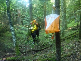
Kate started us out by heading to nearby CP 1 and hit it straight on. Then she took us to CP 2 and CP 3, perfectly. Cliff kept asking if Kate needed any help, but by CP 3, he and Starker were about 10 steps behind, laughing at Kate being totally locked in the “o-zone.” She wasn’t talking or turning around to see if her teammates were keeping up; she just kept up a very fast hike and steered us ahead. Next we hit CPs 22, 23 and 21, with a bit of a stumble at 23 given there were a few similar features around. Most of the points were located either on the tops of hills or in the bottom of deep depressions, so there was a lot of climbing involved. Some of the vegetation got quite thick, so it was pretty slow going, and really at no point did could we use any trail or road for any period of time to get between points.
From CP 21, if we had gone east to CP 11, we probably would have ended up getting more points. But instead we chose to go north and try to hit CP 20, thinking we had more time than we actually did. We walked for a long stretch and Kate eventually got us on what we thought was the correct trail to attack from, east of the CP, but after a lot of walking west, we could not find Adeline Lake, where the CP was, and we were pretty sure we had walked past it. So we recovered by hiking south toward the road to reevaluate our plan.
By this time, it was full daylight out, and the mosquitos were out in force. Like, probably the worst we’ve ever seen it. We were wearing full rain gear, so the places they could bite us were limited, but whenever we stopped, dark clouds of bugs swarmed all over our faces, and in order to study the map, Cliff and Starker needed to fan and swat away the masses of bugs trying to get at Kate. It was pretty intense and unpleasant.
We reached the road a little confused about our whereabouts. Fortunately, we came across two guys in shorts and t-shirts, loading up their car with camping gear. They clearly were wondering who the freaks were walking around at 9 a.m. in full raingear on a sunny and hot day, so naturally, we introduced ourselves as adventure racers and asked if they might help locate us on our handy 8.5x11 paper map, rather than on a phone or GPS. After realizing we were relatively harmless, they did help us out, and they also gave us the unsolicited advice that if we wanted fewer bugs, we should produce less carbon dioxide and sweat. Super useful advice! All we needed to do was stop walking and breathing.
Re-found on the map, we changed our plan to go after CP 17, then CP 18, which we found without major issues. We thought about going after CP 19 but weren’t so excited about getting back out of such a deep spot in the woods, so we went back to the road and then ducked down to CP 11, then 10, then 8 and 5, finding all easily. At this point, it was almost 10 a.m. and so instead of going down to pick up CP 6 and 7, we modified our plan to just get CP 4 on our way out. Naively, we headed due west down the hill and into some thick vegetation near what looked like a swamp on the map. However, when we got close, we saw a lot of open water. Not good. We bushwhacked our way toward the narrowest spot of swamp on the map and found a beaver dam. Kate and Starker tried the water to see how deep it was, and it seemed too deep. Cliff tested the beaver dam’s integrity and felt pretty positive about it, but Starker was hesitant, and as he was telling a story about how beaver dams can collapse and the sucking vortex of moving water can drown you easily, Cliff slipped and part of the dam came apart under his foot. OK, never mind, we’re not walking across the dam. (We found out later that at least two teams had used the dam without a problem, and the Paula had used it as well while setting the course).
A little worried about time, we tried to work our way through other areas of the swamp, but kept running into large swathes of open water. At 10:20, we were freaking out. It was past our deadline to get back to the TA and we now faced a long slog in the wrong direction to get around the swamp/lake. We headed back up to CP5 and past it, crossed Eighteenmile Stream, then turned north and crossed it again. We then climbed uphill to a plateau that we knew we could follow directly west to get to a major road that would take us to the TA. We were running where we could, but there was thick undergrowth and fast travel was not easy. It was pretty stressful and seemed to take forever, but finally we reached the road, ran north along it until we reached the campground and the TA.
We felt pretty good that we had made it back with enough time to give ourselves a chance to finish before the cutoff, but then Cliff started studying the maps a little closer and realized it was more like a 11-12 mile bike ride back, rather than an 8-mile ride (he had thought two maps connected but there was really a third map in between). As quickly as possible, we mounted up and rode out, with bike navigator Cliff realizing that one bad decision could doom the team (given we would lose one point for every minute we were late). We pushed hard up and down some hills, then faced some hotter biking on some sunny roads, but we were on a mission and nothing was slowing us down. Starker was flying ahead and Cliff and Kate tried their best to stay with him in a paceline. Kate was giving regular updates from her odometer about our speed and distance covered, and Starker was convinced we weren’t going to make it. But about halfway through, the math Kate and Cliff were doing seemed like an on-time finish was looking likely, if we didn’t run into any unforeseen obstacles (never a given in AR).
We got on the last map and Cliff could see the exact mileage to the finish and knew the team would make it. He didn’t tell Starker though, because Starker was on a mission and pulling us all forward. Finally, after an excruciating couple of hours of effort and stress, we got on the familiar last stretch of road to the Lakewoods Resort and pulled around the hotel to the finish line, where we were cheered in by practically everyone else in the race and the smell of cooking burgers. It was 11:50 a.m. - we had 10 minutes to spare.
Relieved, exhausted and famished, we weren’t quite sure what to do with ourselves after we finished. We hugged and sat and stared at nothing for a while, trying to drag ourselves out of race mode and into celebration mode. We got some food and some cold drinks and sat down under the shade of the event tent. Sadly, the last team on course came in four minutes late, meaning they lost four hard-earned points, reminding us again why we always play it so conservatively when it comes to finishing on time. Even with that strategy, we had barely made it, and Cliff and Kate remembered our crazy finish at the Cradle of Liberty and the 2015 Stubborn Fool, where in both races we crossed the line with less than one minute to spare.
Taking off our shoes felt great, as did sitting down and eating. Actually, pretty much everything felt great. We had conquered the Stubborn Mule, raced hard for 30 hours, and worked great as a team! We were ready for a relaxing weekend with friends in Madison. And more importantly, we knew we were as ready as we were ever going to be for ITERA.

