2015 TETON OGRE
In the summer of 2015, Kate and Cliff headed out on a road trip throughout the western U.S. Starting from Wisconsin, we climbed the high points of Nebraska, Utah and Idaho before ending up in Driggs, Idaho for the 2015 Teton Ogre Adventure Race, a 15-hour race put on by Abby Broughton and Jason Popilsky, two members of Tecnu Adventure Racing, the best AR team in the U.S. We got into town on Thursday evening and checked into a room at the Teton Valley Cabins, which was great, and went out to a fantastic dinner down the street. We spent the next day checking out the town, buying food from the local co-op and farmer’s market and gear from the two outfitters in town - we loved everything about Driggs. Tucked in underneath the Tetons, it’s a small ski town with a great outdoor vibe (20 minutes from Grand Targhee) but none of the bling of Jackson. In another life, we would live there (or maybe if this one changes course???)
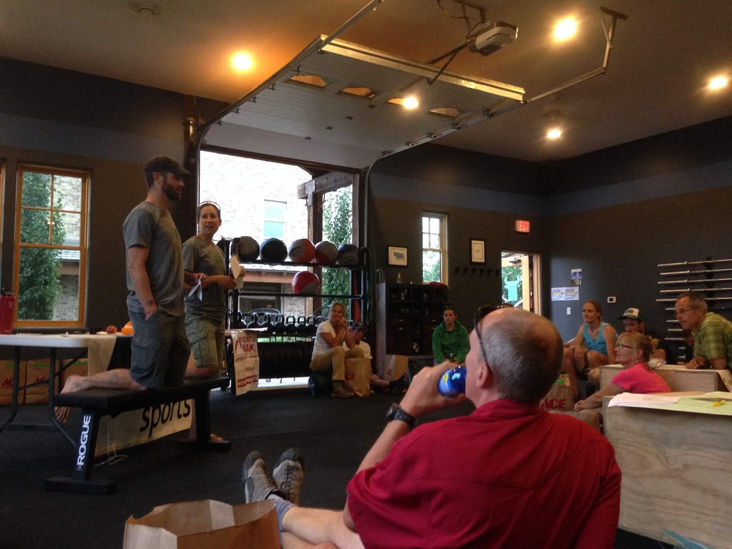
Anyways, race check-in was Friday night, and we met Abby and Jason at the local Crossfit gym, where Abby works when she's not racing, and received and plotted our maps. The course looked straightforward enough - a short run as a prologue, then a 16-mile paddle down the Snake River in an inflatable kayak, followed by a 10-mile on-trail hike up and over an 8,000-foot summit, including a 1-2 mile bushwhack to the TA, then an 18-mile mountain bike to a 6-point o-course and down 2,000 feet of elevation gain to the finish. There were only five teams participating in the 15-hour race, but it would be an early morning for us, as we had to be at the race finish for the ride to the start at 4 a.m.
We got to bed at a reasonable hour and despite knowing it was coming, the 3:15 a.m. alarm still scared the bejesus out of us. We quickly recovered, jumped in the car and headed to the meet-up spot. Unfortunately, the GPS led us down a crazy dirt side-road into a dead end at someone’s house. We were pretty nervous about missing the start, but we ended up retracing our steps and seeing a bunch of cars headed up the road we thought we had to take. They led us right to where we needed to be, and we grabbed our gear and jumped in the van that would take us to the start. We had a good conversation about life in Driggs with the other racers (at least those who weren’t dozing) on the 1.5-hour ride to the start. We arrived to a parking lot to see Jason busy pumping up the last of the inflatable kayaks and the kayak put-in nearby. We were given some time to get ourselves organized, and fortunately there were two bathrooms that we both took advantage of.
We got to bed at a reasonable hour and despite knowing it was coming, the 3:15 a.m. alarm still scared the bejesus out of us. We quickly recovered, jumped in the car and headed to the meet-up spot. Unfortunately, the GPS led us down a crazy dirt side-road into a dead end at someone’s house. We were pretty nervous about missing the start, but we ended up retracing our steps and seeing a bunch of cars headed up the road we thought we had to take. They led us right to where we needed to be, and we grabbed our gear and jumped in the van that would take us to the start. We had a good conversation about life in Driggs with the other racers (at least those who weren’t dozing) on the 1.5-hour ride to the start. We arrived to a parking lot to see Jason busy pumping up the last of the inflatable kayaks and the kayak put-in nearby. We were given some time to get ourselves organized, and fortunately there were two bathrooms that we both took advantage of.
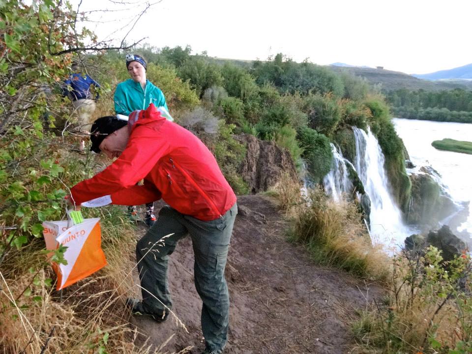
At 10 to 6, the five teams got their photo taken and then Abby decided just to start the race, just as it was starting to get light out. We were given our prologue maps to plot two or three CPs and the kayak put-in, which gave us a nice reference point and made it seem like we had about a mile or two of running to do. We finished our plotting first and ran on the road away from the kayak put-in for five minutes to hit the first CP at an overlook over the Snake River. Abby snapped a photo of us here and I wish I had taken another moment to pose, but we had teams hot on our heels. We ran downhill on the paved road leading back to the canoe put-in and teams started coalescing as we searched for and found CP2 up a reentrant in the woods. There may have been a third CP on the way back to the TA (and if there was, we got it), but all we could think about was using the bathrooms again - dinner was not mixing well with a downhill sprint on pavement!
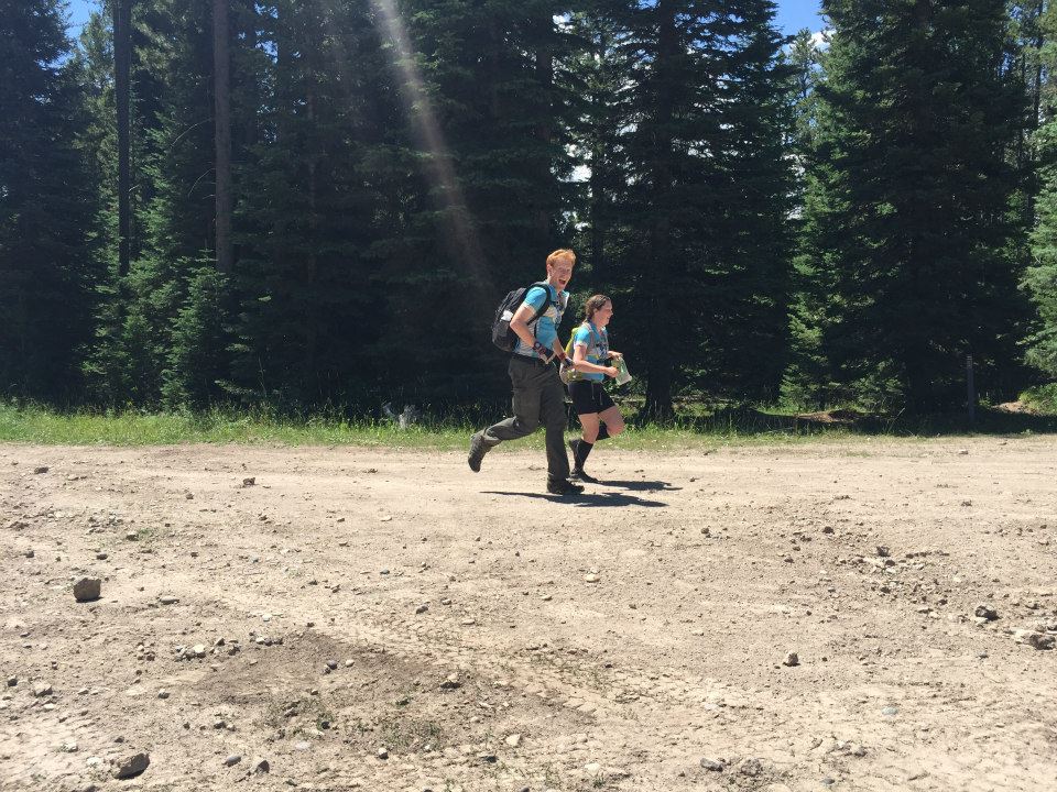
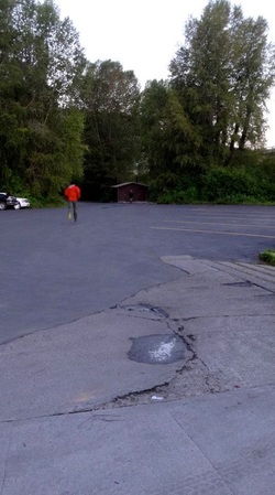 Sprinting for the restrooms...
We made it back to the restrooms, but by the time we got on the water, we were in last place, though all the other teams were in sight just ahead of us. The water was flowing fast, and we knew we were going to be in whitewater for most of the way downstream. The route had no CPs until the takeout, so we didn’t have to worry about anything other than paddling hard and staying in the strongest part of the current. While some of the other teams struggled in the inflatable kayaks, we felt pretty comfortable and started passing all the other teams one by one. Even though they were inflatable, the two-person kayaks were sturdy and held up well in the nearly constant Class II and III rapids. Due to the strong current and need for maintaining control of the boat, it was hard to stop paddling for more than a few seconds to drink or get something to eat, but fortunately, it was early in the race so we weren’t that hungry yet, and as for water, plenty of it was getting in our mouths as we splashed through the wavy whitewater. Once in a while, we were able to sneak glances of the wild and beautiful surroundings we found ourselves floating through. There was very little development on the river, just pristine Idaho wilderness. We did see several campsites, mostly occupied, though due to the early hour, people were either still sleeping or just starting fires, sitting and watching us float down the river as they drank their morning coffee. Occasionally, we hit a cliff that forced the river to bend sharply left or right. Once or twice, Kate, who was navigating, guided us into smaller channels that bumped us down some splashy rapids running through a tunnel of green vegetation. The takeout and TA were just after a large island, and were pretty easy to spot if you knew to look for them, but definitely not un-missable. Still, we got in first, pulled our boat to the waiting truck, and Jason and another volunteer greeted us with a “good job.”
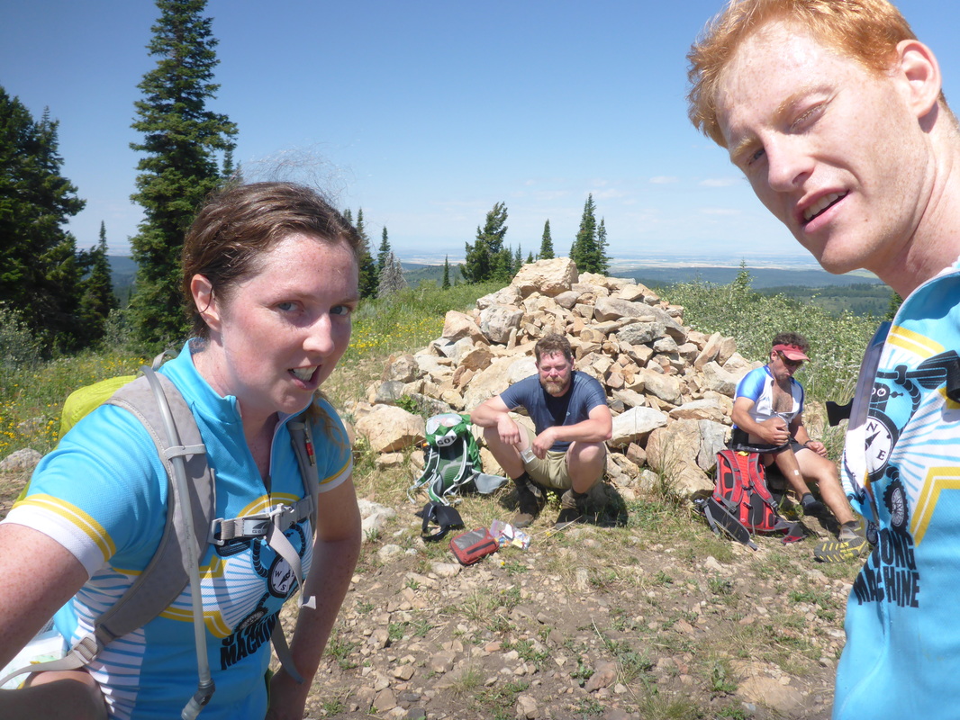
Well, maybe not so much, as we ran out of the TA heading down a road that promptly circled back and led us back into the TA. Well, at least we now knew where we were and what the scale of the map was. At this point, we also saw another team come in - Amy and Cory Hatch from Team GarageGrownGear. They quickly caught up to us and we settled into a one- or two-mile run down a dirt road to the trailhead. We chatted a bit and then they took out a bit of a lead, just in time to spot a CP for us - a waterwheel where we needed the total number of fins spinning. There was a family camped there and we tried to be as discrete as possible making our way through their campsite to check the waterwheel out, but it turned out they were awake and excited to be a part of a race. We continued on the road until it turned into a singletrack trail and then kept up a good pace (mostly running, with a little walking thrown in), at one point catching back up to Amy and Cory and getting a chance to chat with them as we ran (even though we were racing against them, our competitive juices waned when we found out they were such good people!) They got away from us again, and this time we were not as fortunate as to see them take the correct turn up the mountain while we continued on the trail that paralleled a stream. We hit a fork in the river about a quarter mile later, studied the map and realized our mistake, then backtracked to the correct trail, which turned straight uphill and stayed that way for 3.5 miles and 3,000 feet of elevation gain. The climb was on a trail that had switchbacks on the steeper, upper section, but it still took us about an hour to get to the top. On the ridge, we had to do a 1/2 mile out-and-back to get the next CP, which was a pile of rocks we had to take a selfie at, and on the way we passed Amy and Cory and another two-person male team that had taken a more direct route up the mountain and probably saved themselves 20 minutes. Ahead of us, somehow, was another climb, this time of 1,000 feet, which Kate was not too keen on, as it was getting hot out. She curled two fingers onto the tow on Cliff’s backpack and we headed to the top, which had pretty amazing views, but unfortunately, no trail down the other side, where the next TA sat, about 2.5 miles away. At the top, we had to take a picture at another rock pile, and as we got there, we saw the two-person male team taking a break. Perhaps the altitude got to us here, because it seemed like a good idea to try to look upset in our photo in response to the other team sitting right on the rock pile and “ruining” our photo. You can see the result here:
Well, maybe not so much, as we ran out of the TA heading down a road that promptly circled back and led us back into the TA. Well, at least we now knew where we were and what the scale of the map was. At this point, we also saw another team come in - Amy and Cory Hatch from Team GarageGrownGear. They quickly caught up to us and we settled into a one- or two-mile run down a dirt road to the trailhead. We chatted a bit and then they took out a bit of a lead, just in time to spot a CP for us - a waterwheel where we needed the total number of fins spinning. There was a family camped there and we tried to be as discrete as possible making our way through their campsite to check the waterwheel out, but it turned out they were awake and excited to be a part of a race. We continued on the road until it turned into a singletrack trail and then kept up a good pace (mostly running, with a little walking thrown in), at one point catching back up to Amy and Cory and getting a chance to chat with them as we ran (even though we were racing against them, our competitive juices waned when we found out they were such good people!) They got away from us again, and this time we were not as fortunate as to see them take the correct turn up the mountain while we continued on the trail that paralleled a stream. We hit a fork in the river about a quarter mile later, studied the map and realized our mistake, then backtracked to the correct trail, which turned straight uphill and stayed that way for 3.5 miles and 3,000 feet of elevation gain. The climb was on a trail that had switchbacks on the steeper, upper section, but it still took us about an hour to get to the top. On the ridge, we had to do a 1/2 mile out-and-back to get the next CP, which was a pile of rocks we had to take a selfie at, and on the way we passed Amy and Cory and another two-person male team that had taken a more direct route up the mountain and probably saved themselves 20 minutes. Ahead of us, somehow, was another climb, this time of 1,000 feet, which Kate was not too keen on, as it was getting hot out. She curled two fingers onto the tow on Cliff’s backpack and we headed to the top, which had pretty amazing views, but unfortunately, no trail down the other side, where the next TA sat, about 2.5 miles away. At the top, we had to take a picture at another rock pile, and as we got there, we saw the two-person male team taking a break. Perhaps the altitude got to us here, because it seemed like a good idea to try to look upset in our photo in response to the other team sitting right on the rock pile and “ruining” our photo. You can see the result here:
We searched a bit on top for a trail to the north, but in vain, and so we set a compass bearing and headed downhill, at first through thick evergreens but eventually through more navigable terrain as the vegetation thinned out a bit. Cliff let out a few “Hey bear!” yells just to be sure but we didn’t see anything large and fuzzy moving in the woods. We were looking for an east-west that intersected our route, but we came out on a network of dirt trails that gave us some confusion. We eased off and looked at the map, then worked our way down a bit, then stopped to look at the map more, then just decided to keep heading downhill, where we eventually popped out onto a big dirt road. We turned right (east) and followed the road into the TA, which we hit at a run.
At the TA, our bikes were waiting, along with Jason and some deliciously cool and fresh watermelon cubes. We could have been faster in this TA, but it was hot and, well, rushing is just not our style :) While we refilled our water bladders, I asked Jason what Kyle Peter says when he’s waiting for you to hurry up at a TA. “He doesn’t say anything,” Jason said, “He just stares.”
The first bit of the bike ride was on a rolling dirt trail that was difficult to ride. We moved at about 5 mph through the first couple of miles, riding where we could and walking where we couldn’t. The biggest problem was the enormous trench dug by dirt bikes through the middle of the path. The second biggest problem was the dirt bikes themselves. On this gorgeous Saturday, there were dozens of bikers out for a ride, and you could hear them coming from far away, their engines roaring and disturbing the peaceful calm of the forest. They usually rode in packs, and after the first rider passed, he or she would hold up fingers to show how many more riders were to follow. Often there were five or more bikers spread out by around 30 seconds each. We easily lost 20-30 minutes waiting for these bikers to pass us through the course of the race.
There were a few minor route choices in the next five miles but also other trails that veered off in wrong directions, so Cliff had to keep stopping to make sure where we were on the map, which was difficult to do while riding due to the bumpy terrain. The first bike CP was a little hike off the trail - a required picture of a natural rock obelisk. Not long after, we hit an second optional point which required an extra mile of biking down to a pond, where we took a photo of ourselves, and then a route choice between an uphill bushwhack back to the correct trail and a retrace of our path back the mile to the intersection with the correct trail. We chose the latter and found out later that it was a good decision, as the bikewhack was thick and slow going. After this, Cliff had a moment of panic when he worried he had lost the passport, and he endo-ed off his bike while checking his pocket for the passport instead of steering with both hands (the passport was safely tucked away behind a zipper, so he shouldn't have worried). Kate had also crashed earlier, and while both crashes had only left bumps and bruises, it made the next section of the stage, a 3,000-foot climb up a steep slope to the top of a 9,000-ft. peak, even more painful.
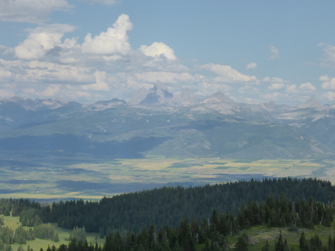
For the better part of an hour, we leaned into the hill and forced our way, inch by inch, up the 50+-degree dirt slope. The going was made even slower by the motorcycle trench, which was several feet deep along most of the trail. Kate in particular struggled and Cliff helped her by hustling up with his bike for 200-300 feet, then returning and taking hers. Even though we had taken a liking to Abby and Jason, this hill had us cursing their existences. However, when we finally reached the top, our frowns of anger turned into whoops of joy. The entire Teton range was laid out before us in a stunning panoramic view. In awe, we took an impromptu break at the CP, eating some snacks (Kate laid into an apple with serious tenacity) and taking in the view.
It was now 5 p.m., and the race cutoff was 9 p.m. With at least five more miles of biking in front of us and some gnarly hill climbs on an upcoming orienteering section, we knew now that we probably wouldn’t clear the entire rest of the course that lay in front of us. Still, having (literally) gotten over the hump of the course, we were confident we could finish strong. The ride from the top was some really fun downhill, though Kate struggled due to her failing brake-pads, especially on the steeper sections. We hit a few more CPs on the way to the o-course, and as we got closer, we were both looking forward to getting off our bikes.
However, this was when we made our one big navigational mistake of the race. At one particular point in the map where there was a four-way intersection, Cliff thought we were at a different intersection just a quarter-mile further on. Misleading signage didn’t help. We turned left when we should have gone straight, and ended up at a place with very similar topography to what we were looking for. What cinched our bad decision was seeing Amy and Cory from Team GarageGrownGear - a team we thought would be way ahead of us by this point. They weren’t sure if they were in the right spot, and thinking we knew exactly where we were and also excited to be helpful, we told them, “Follow us! The CP is just over this hill!”
According to the map, we were supposed to follow a trail that looked like it ran the ridge. We found a trail that did that, but after 10 minutes or so, it disappeared into a steep descent, which it was not supposed to do. We looked in vain for the CP with Amy and Cory but couldn’t find it, and then rationalized that the scale on the map must have been much smaller than it appeared. We all retraced our steps back to our dropped bikes, but while Amy and Cory stopped and eventually figured out their mistake, Cliff and Kate continued further on the wrong trail, following it uphill (it should have been going downhill) to a ridgecrest with a huge radio antenna. By this point, we knew we had messed up, but it took 10 minutes of sitting and staring at the map for it to make sense. Eating crow, we had to lose all the elevation we had gained, and at a walk too, because the trail was steep and narrow here. We finally made it back to the intersection, made the correct turn and ended up in the section that matched up with the o-course on the map. Unfortunately, by this time, it was 7:30 p.m. and we had no time to search for points. This frustrated us enormously, as we really wanted to do some orienteering but couldn’t due to our own mistake. We might have been able to get one point that was temptingly close to the trail, but we really were concerned about the cutoff and didn’t want to risk missing it, so we passed it by.
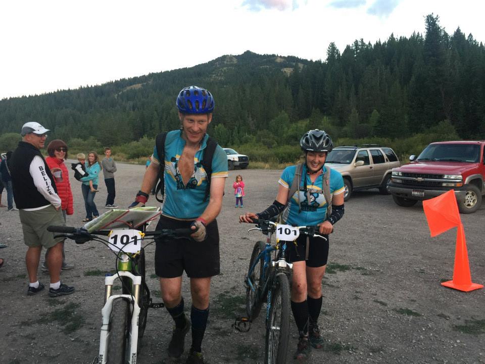
The remainder of the race consisted of a 4,000-foot descent off the mountain to the finish, with one mandatory CP about three-quarters of the way down. Cliff, riding Starker’s Niner, was having a blast on the fast and smooth switchbacked downhills, but at first Kate struggled, as her 20-year-old Stumpjumper wasn’t up to the task, especially we completely burned out brake-pads. However, the frustration bubbling inside both of us must have boiled over for her, as she let go of her fear and inhibitions, picked her feet off the ground and started moving fast. She started riding everything - steep downhills, deep mud-pids, wooden bridges, and keeping up a great pace. During one particularly fun straight section of trail, we saw Cory and Amy’s bikes laying of to the side, and a moment later, we saw them apparently in search of the CP. Knowing we had already messed up their race by giving them bad directions and having them follow us to a mystery CP, we felt sheepish telling them they were searching in the wrong place, but Cliff was locked in on the nav now and we stopped to at least tell them where we thought we were and how it was still another 10 minute ride to the CP. Graciously, they took a look and agreed it was further on, then mounted up and quickly outpaced us downhill. That was a break for us, as they sped ahead and found the CP in a rocky overhang well off the trail. With only about 25 minutes remaining until the cutoff, we probably would have skipped it if they hadn’t led us to it, even though it was mandatory. They continued on their way, and another few minutes later we could hear the crowd at the base of the mountain yell as they came across the finish. Then it was our turn. We sped through a last section of singletrack with tall grass on both sides, then got spit out into a parking lot, where the makeshift finish line was marked with orange cones and a decent crowd was gathered and celebrating. We dismounted and crossed the line with huge smiles on our faces. In contrast to many other AR finish lines, which are generally eerily quiet and devoid of all human life, this place was a party, with music, cheering and delicious-smelling food. Without argument, the best finish line of any adventure race we have participated in.
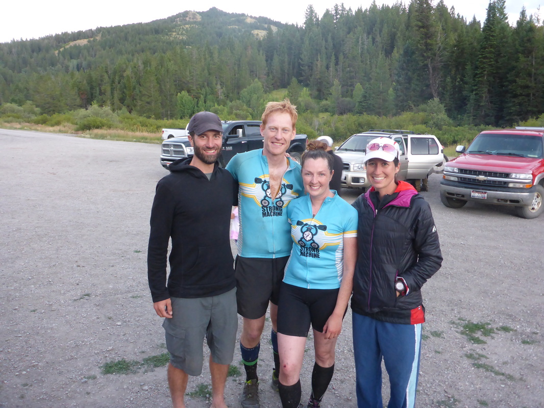
Jason’s brother was making quesadillas and we were both light-headed with hunger as we sat down near our car to dig in. The first bite of those salsa- and sour-cream-smothered cheese vehicles was the most amazing thing we had tasted in our lives. A few more bites and we felt partially restored, after not having eaten anything for about four hours due to our rush to get finished before the cutoff. We got cleaned up a bit, organized our gear and chatted with Jason’s parents, who are just about the nicest people on Earth. We also got to talk with Amy and Cory, as well as Abby and Jason, who were finally able to relax after seeing all three of their events that day finish up as big successes. As it got dark, awards were given out, and we ended up in second place co-ed behind Amy and Cory, and third overall behind an all-male team of local CrossFitters. Cliff was slightly disappointed to miss out on the OutThere pack he had a 50 percent chance of winning in the prize raffle, but Amy’s whoop of joy when she won it was a nice consolation prize. Overall, this was our favorite adventure race to date and we hope we can come back for future editions!

